This has been promoted as one of the best and longest descents in an unpopulated valley – the Welschtobel mountainbike route. For a long time I’ve been trying to ride it, and now in early October 2023 was finally able to do it – and bring along Farkas.
We left the Davos hotel by car and stopped at a trailhead in Alvaneu, where we’d pick up the car tomorrow if all went well. From this side, the ascent is a long service road plus a steep scramble up to Furcletta, where we’d meet other bikers coming over from the Lenzerheide side.
Then a wonderful flow trail all the way back to Arosa. But here’s the catch: Given we felt still fit and recharged the batteries (literally!) at a restaurant, we rode from Arosa all the way back to Davos via Strelapass.
Blick zur Alp Ramoz und ins Welschtobel, Arosa, Graubünden, SchweizAlp Ramoz mit Ramozhütte SAC, Blick ins Welschtobel, dahinter Davoser Alpen mit Weissfluhjoch, Alvaneu, Graubünden, SchweizFelsenweg mit Blick zum Weissfluhjoch und Weissfluh Gipfel, Davos, Graubünden, Schweiz
We took up the biggest traildog mountainbike challenge yet – around the Swiss National Park in four days. What a fantastic experience, a great ride and Farkas was doing simply so well. We are really grateful that all worked well since we did have a lot of respect for the distances mostly – over 40k during the longest segment. Elevation and trail difficulty luckily were not an issue and all it all it was just a highly memorable trip.
As Farkas is getting more confident and experienced as a trail dog, we are increasing our radius in the Swiss and Italian Alps for full-day bike trips.
He seems just to have the right confidence and control to know where to go and how fast to pace it, both from a safety as well as from an endurance perspective, so most of the time he can happily canter in front of the bike and act as the pace setter. And we got the commands mostly right so he know when to stay behind the bikes in more treacherous sections of the trail.
Add to this a drone in follow-me mode, an empty landscape just after snowmelt (or in some cases, still during snow melt) before the cable car season opens, and a contraption to tie to the bike to add further control, and we have a set of action sequences that work much better than just the GoPro mount at the bike itself.
Day II of Adventure biking saw again perfect weather, so up before sunset and off to and above the ski slopes of Bardonecchia. The ascent this time was not necessarily easier but felt alright – after switching the bike to “Enduro”, which makes an unbelievably big difference!
Caught the sun rising above the French-Italian Alps right at the castle ruins of Forte Jafferau at the beginning of the famous Pramand-Jafferau military historic dirt road that is again perfect for bike-sightseeing (I took the Jafferau entry and ended around lunchtime in the heat at Pramand).
This route is currently open to motorized traffic only on Saturdays so I was quite sure I would be one of the first people up here, and I was – with the exception of a camper that hid next to one of the military huts and I assumed the occupants would be sleeping (did they drive up before or after midnight during the night Friday-Saturday??) so hopefully the drone and the bike exhaust did not wake them up.
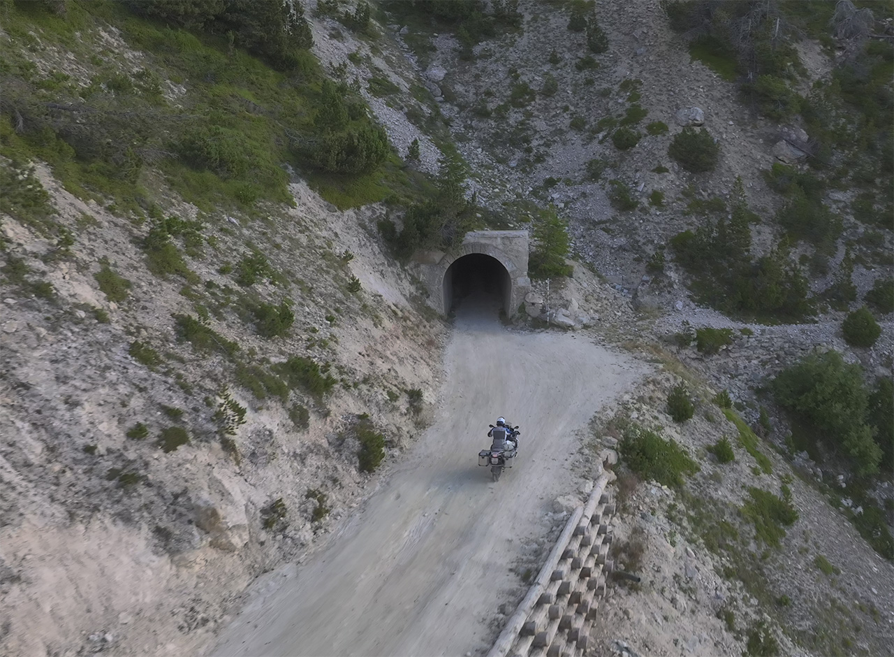
The ride across the military mountain road to Seguret and the famous dark and flooded tunnel was fantastic, so I reached the crossroads to Pramand with no problems at all (other than my water bottle being in one of the side bags without the cap on – surprisingly little spilled). I took a deep breath and entered the cul-de-sac access road up to Fort Pramand, which is the diciest part of the route (and the highest in the Denzel difficulty classification). Keep the throttle on at all times and wiggle your way up is the solution, which worked out well.
This concluded the adventure part of the trip and I headed back to my quarters in Bardonecchia for a lunchtime nap and checkout before the long drive home, this time without the tunnels but lots more of mountain passes straight up north to Wallis. Passed a couple of commercial motorbike photographers, who seem to make a reasonably good business.
What a trip – why did I wait so long to do this type of trialing!
Ascent in the early morning sun to Jafferau, Bardonecchia, ItalySunset at the barracks and fort of Jafferau, Bardonecchia, ItalyAdventuring on Jafferau-Pramand military road, Salbertrand, ItalyFort Seguret ruins on Jafferau-Pramand military road, Salbertrand, ItalyMavic2 in follow-me mode approaching the famous Tunnel SeguretSonnenaufgang am Monte Jafferau mit Militärfortifikation, Forte Jafferau, Drohnenaufnahme, Luftbild, Bardonecchia, Piemont, ItalienFoxphotos caught me on the way from Bardonecchia to Val d’Isère – twice, actuallyPhotographed on Col de l’Iseran and posing just a little bit…
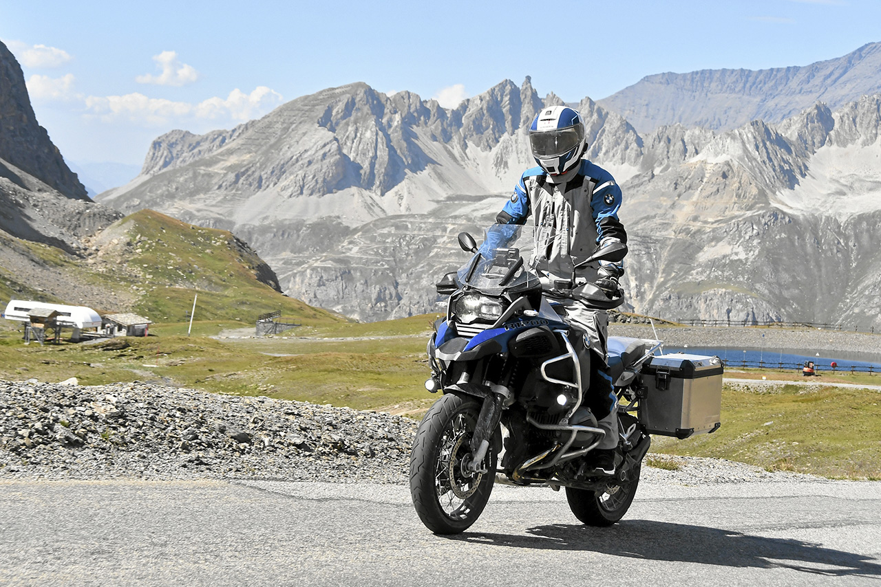
After a nice chat of the person manning the gate where the entrance fee needs to be paid, I was allowed up on the dirt road that leads to Colle Sommeiller – the highest point in the European Alps that is accessible by motorized vehicle (during some days and times). I was not sure I would make it as the Denzel difficulty had markedly increased, but in the end it went surprisingly well, and my main fear – that down would be more difficult than up – was in vain to as rolling downhill was noticeably easier, probably because of my “road” tires.
BMW Motorrad Navigationsgerät am Colle Sommeiller, höchster befahrbarer Pass der Alpen, Italien und FrankreichMann mit Motorrad BMW R1200 GS Adventure am Colle Sommeiller, höchster befahrbarer Pass der Alpen, Frankreich und ItalienSerpentinen am Colle Sommeiller, Blick hinunter zum Rifugio Scarfiotti, Rochemolles, Piemont, ItalienAuffahrt zum Colle Sommeiller, auch Col du Sommeiller, Mont-Cenis-Massiv, Grobe Schotterstrasse in den Piemontesischen Alpen, italienisch-französisches Grenzgebiet, Bardonecchia, Piemont, Italien
As the sun moved higher, even at this high altitude the temperatures kept rising so keeping the BMW bike moving helped keep me a bit fresh, although I could have stayed up there all day would it not have been for the heat and the planned trip to Sommeiller in the evening.
Motorrad BMW R1200 GS Adventure, Colle dell’Assietta, Passhöhe, Namensgeber Strada dell’Assietta, Militäralpenstrasse, Piemont, ItalienSerpentinen am Colle delle Finestre, Schotterpiste, Piemont, Italien
Morning of day 1 took me to Strada dell’Assietta, which seemed the right choice given the long trip to arrive the night before, while still making it to sunrise and staying on the bike rather than falling off – apparently the “Denzel” scale’s difficulty was OK as a start of this offroad / dirt road adventure with my GS.
Bergkapelle bei Sonnenaufgang, Cappella Broussailles, Assietta Militärkammstrasse, Sauze d’Oulx, Piemont, ItalienMogenstimmung, Bergsee und Assietta Kammstrasse am Colle Basset, hinten die Alpen im Italienisch-Französischen Grenzgebiet, Sauze d’Oulx, Piemont, Italien
I had hoped for better weather to experience the sunset, but the wind was so heavy and the temperatures dropping quickly that I just hiked out on the trail a bit and back to make it back to the hotel for a cozy evening.
Wanderweg, Aussicht auf die schwarzen Berge nahe Gospel Pass (Bwlch yr Efengyl), Black Mountains, Wales, Vereinigtes KönigreichWanderweg, Aussicht auf die schwarzen Berge nahe Gospel Pass (Bwlch yr Efengyl), Black Mountains, Wales, Vereinigtes KönigreichWanderweg, Aussicht auf die schwarzen Berge nahe Gospel Pass (Bwlch yr Efengyl), Black Mountains, Wales, Vereinigtes Königreich
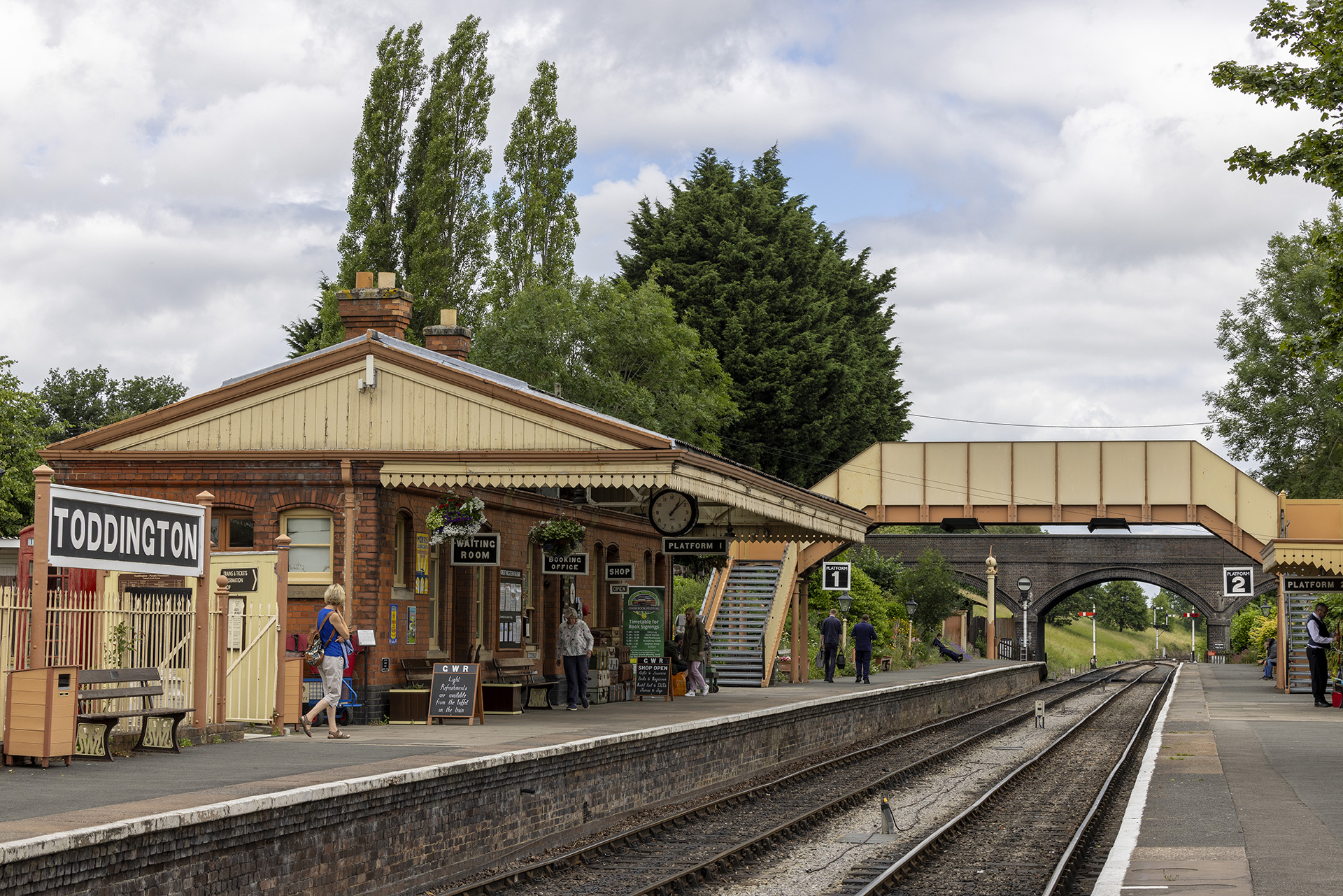
On my way to Wales, I seemingly read the timetables correctly and was able to meet the two trains, one in either direction, on the GWSR line at Toddington station.