Today it’s Friday and that means concluding the week with a BIG hike! We have the Ka’u desert on our program, and there was a choice of either doing a return hike or doing a full thru-hike to the other side of the Caldera, which would be approximately 9 miles if we hiked it direct, along the trail.
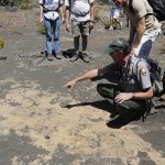
So there was another impressive line-up of scientists and teachers and interpreters who would show us around. After about an hour of theory in the classroom, we met at the Ka’u desert trailhead along Highway 11 and were accompanied by both a volcanology teacher and the Park’s archeologist to discover the footprints cast in a muddy lava and lapili fallout after the 1790 eruption event, when Keoua’s army and other traveled along this area. In addition to the preservation of the footprints, there is also a series of “C-shaped” low temporary shelters that acted as night camp for the travelers and protected them from ash, wind and rain. We checked upon the kaoiki fault system that belongs actually to Mauna Loa and not to Kilauea during the expansion of M. Loa towards the sea. This was sort of a competition between Mauna Loa and Kilauea, as they “cast” lava onto each other subsequently and mutually. In the sense of “Says Mauna Loa to Kilauea: I’ll lava you if you’ll lava me” 😉
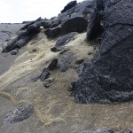
We hiked across the Ke’amoku lava flow that is sharply separated into A’a flow first and then followed by soft and very nicely formed Pahoehoe flows later on. Here’s were you find the C-shapes and the first footprints. Futher footprints are all over the place, but given the desert area and the size of the protected park, archeologists are really busy to identify all the items in the field.
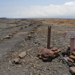
It was not always easy to find the trail as the common hiker, so we should always watch out for the carefully erected “A’hu” rock stacks that will guide the way. We arrived at a Tumulus along Kilauea’s eastern rift zone, the kind of feature you would find in your oven: Like a blackberry muffin, the lava welled up and formed cracks at the top of the “cake” so to say, before splitting open a little and ejecting just a little bit more. Remains an intense structure – a tumulus.
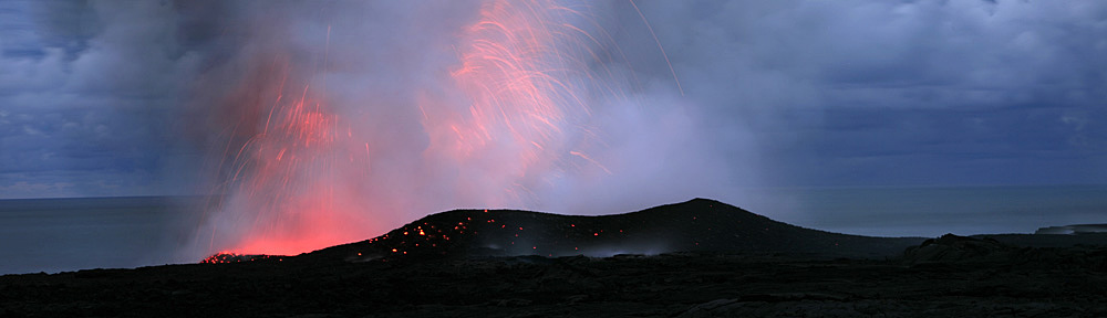
We reached the summit of the small and not so aptly named Mauna Iki (small mountain) and continued on along the principal Ka’u desert trail. It was getting hot, and our water and lunch provisions were dwindling rapidly. A cool wind was a welcome change, but this also meant we were likely to hit the plume – the gaseous exhalations of the active vent at Halema’uma’u, and at right about this time my SO2-beeper would go off, indicating a reading of more than .5 ppm of SO2 in the air. I think we reached about 9 ppm at the peak, just when we reached a bit more than halfway of the trail and the most interesting features. There was a lot of Pele’s hair, golden and long and quite wonderful were it not so stingy and probably unhealthy to inhale. We reached the twin pit craters and the bottomless cone and did of course peer into it, not without the required respect and awe, however. There were also a few hardy O’hia trees (rather shrubs) out here, and some tropical birds, quite astoninglishy.
We made it across the desert in good time and reached the end of the trail at the camp site we were to be picked up around 4.45 right when the van was shuttled down to get us. What a day! The rangers are really knowledgeable and always throw a story and a joke in. Thanks guys, although I am sure I will feel my muscles and legs tomorrow after what was probably more than 12 miles rather than the 9, with all the side trekking. Felt like back in the old field excursion days!


-
- Hiking the Ka’u Desert, Hawai’i Volcanoes National Park, Big Island