Already two months gone, and halfway through my stay here at HAVO, incredible!
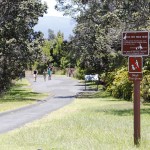
Today I was shadowing Melissa on her Devastation Trail guided hike, which is down beyond Nahuku (Thurston Lava Tube) on the leeward side of the 1959 Kilauea Iki eruption – where all the fallout was, and therefore where all the rainforest and infrastructure got destroyed from lava fountains and ash and tephra as high as 1900 feet, including the Crater Rim Drive.
Thinking about putting together my own program for this trail, that’s actually a pretty strong impression that we can cast upon the visitors: Crater Rim Drive had to be closed and repositioned three times – this being the first time:
– After 1959, they had to build a rather large bypass around the devastated area.
– In 1983, the Kaoiki Earthquake destroyed the part right next to the visitor center, what is now known as Earthquake Trail
– In 2008, the southwestern part of Crater Rim Drive got closed for the ongoing eruption at Halema’uma’u.
Life of constant change!
Also life of constant change is how the rainforest and the plants are recovering in the devastated area, especially the Ohia trees venturing out first, followed by Ohelo. I actually was not aware that there are two varieties of Ohelo, a tree (with larger leaves) and a brush or shrub, but both having sort of the same type of berries.
Venturing out from the original part of the rainforest into the fallout area, there is a lot of ash and cinder, but large bombs of rocks are stuck in some of the trees that survived the event. I first did not believe that this are for real, but I was confirmed over and over they were not placed there and are really stuck fast from the impact.
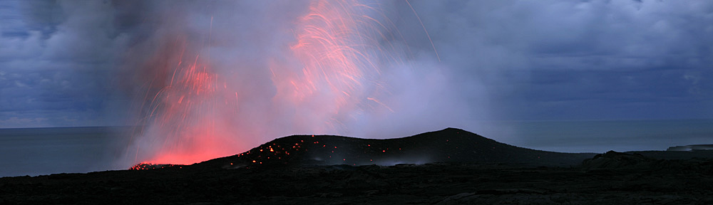
And then, there is Olivine and there are Pele’s tears to be found (see Daily photo)! I think this is going to be an interesting discovery for the visitors, and I can talk a lot of geology and volcano in addition to the plants.
-
- View into Kilauea Iki Crater